
advertisement

Western Europe, and therefore the Alps as well, experiences strong westerly supply, meaning one disturbance after another could reach the Alps. This has caused a lot of snow to fall, especially on the highlands, in recent days. After today, the Alps will be in calmer waters for a while.
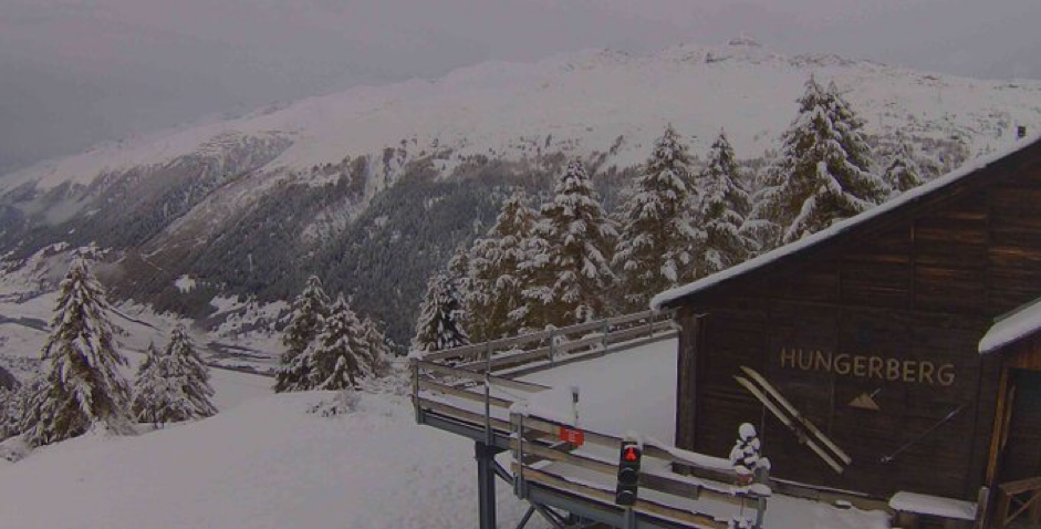
Meters of snow locally this weekend
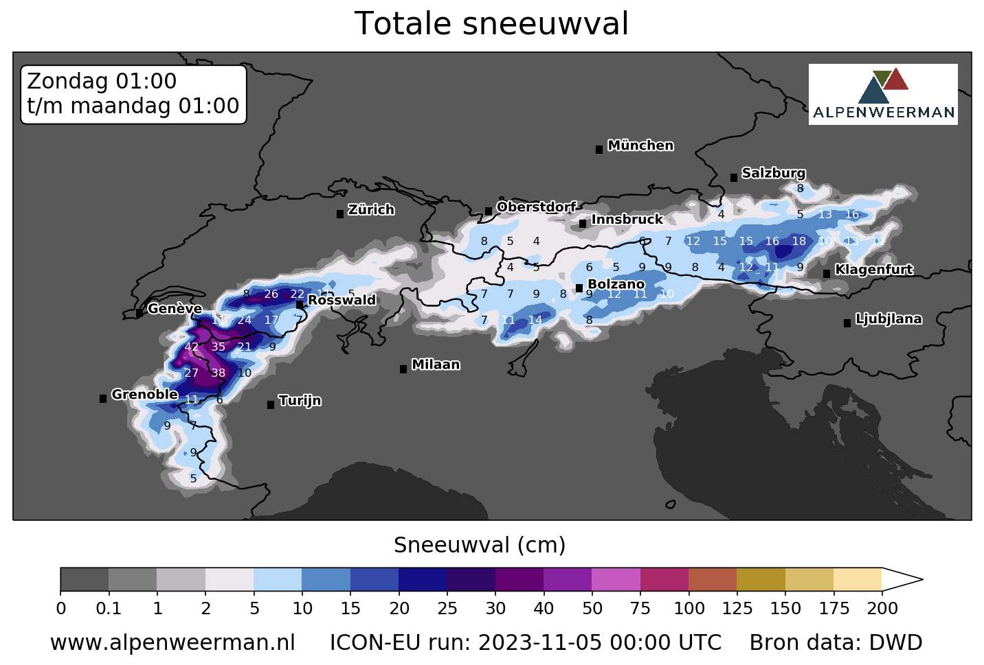
A large disturbance is moving from the southwest to the northeast across the western Alps today. The French, Italian and Swiss Alps in particular are seeing rain today. The focus appears to be on the borders with France, Italy and Switzerland. From an altitude of approximately 1,500 metres, this rain falls in the form of snow. The freezing point fluctuates around 2000 metres. In the area just mentioned, about 20 to 40 cm will fall today from an altitude of 2000 metres. The winds come from the west and are often moderate in strength. In total, the amounts of snow that have fallen since yesterday may reach a meter! What a start to the winter season for the higher mountains!
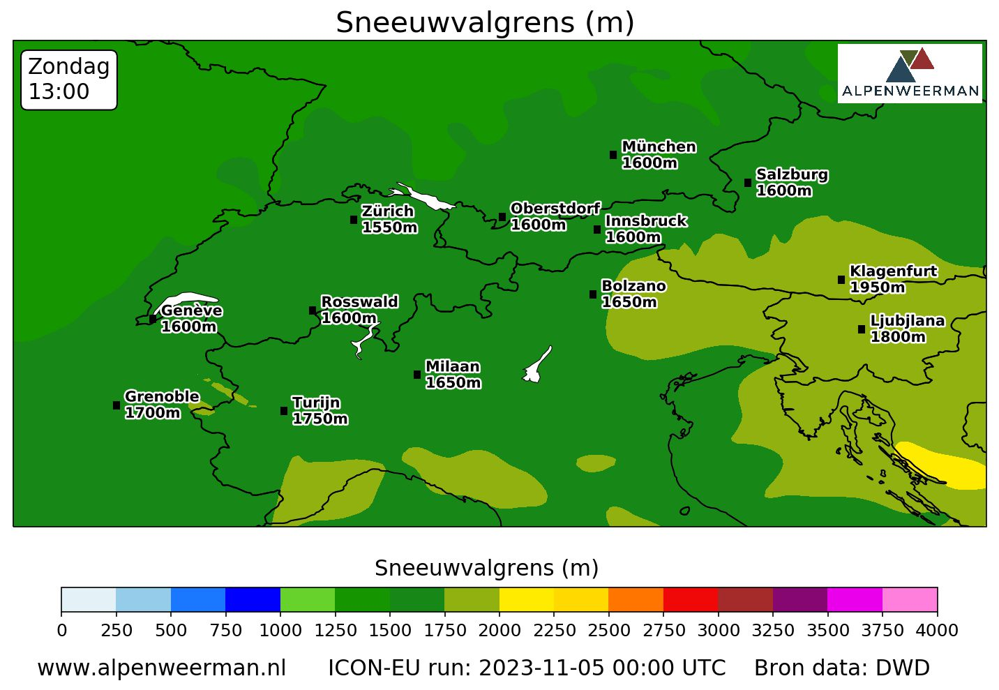
In the rest of the Alps we are also seeing snowfall today, although in a different order. It snowed mainly in Salzburgerland and Carinthia on the snow map below last night. However, the snowfall limit is much higher in Carinthia. About 2000 metres. Southeastern Switzerland and much of Tyrol have the best chances for drier conditions with a chance of sunshine this afternoon. There is a lot of sun directly on the eastern side of the Italian Alps, where the blue is clear with a lot of sun. This is because all clouds and rain are blocked by the highest mountains.
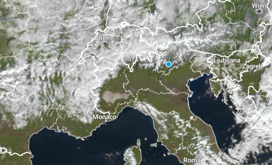
The satellite (source: Weerplaza) shows that it is clearly sunny, especially on the eastern side of the Italian Alps. Southeastern Switzerland and Tyrol will also see some sun today.
Why is it remarkably sunny in Italy? This is because the air is pushed towards the mountains by strong western winds. Clouds form due to condensation and rain and snow falling on the western side. The air descends to the back of the mountain, dries up and takes the heat with it. The temperature could also reach a maximum of 17 degrees there today!
Breathing space, more sun, and often cold and dry
From tomorrow the Alps will enter somewhat calmer waters. Since high pressure over southeastern Europe can exert a slightly greater influence on the Alps, active disturbances remain somewhat distant. However, Mondays, Tuesdays and Wednesdays seem to be the best days. The sun will appear itself regularly on all days. The wind will also remain calm.
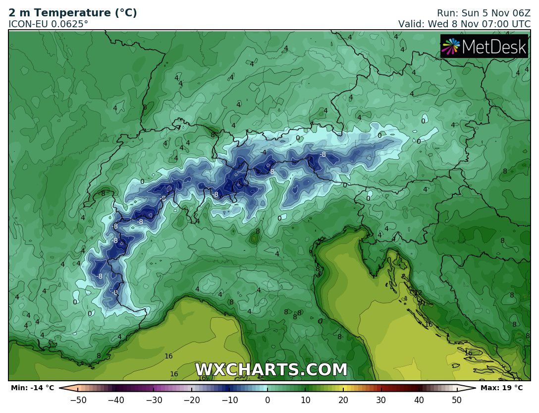
However, the weather will not remain completely dry, as there is a chance of rain on Monday and Tuesday. Right now, Wednesday has the best qualifications to remain completely dry. If there is a shower, depending on the altitude, it may be rain or snow. The snowfall limit tomorrow will remain at an average of 1,500 metres, but will gradually decrease. On Wednesday, the average snowfall is about 1,200 metres. Of course, the frost line will also drop as a result, as it will be around 1,500 meters on Wednesday. Overnight, there will be a light to moderate frost in the mountains, and on Wednesday night it will be locally severe as well, at around -10 degrees.
We conclude that the weather will be calm and wintry in the coming days, especially above 2000 metres. Winter is already starting to warm up in the mountains. The open slopes in the high mountains will be in excellent conditions at the beginning of next week.
Subject to change again, and perhaps a lot of snow will fall again over the weekend
As of Thursday, the Alps also appear to be falling prey to active disturbances again. It’s still too early for details, but from the west, rain will fall during the day Thursday and snow will fall again at higher elevations. This is the beginning signal of a new volatile period. As of next weekend, the upper air also appears to be getting colder again and we can likely expect new snow in many places.
(Visited 376 times, 376 visits today)

Traffic controller and slip coordinator at Rijkswaterstaat. He is also a junior meteorologist at Weerplaza.